


")
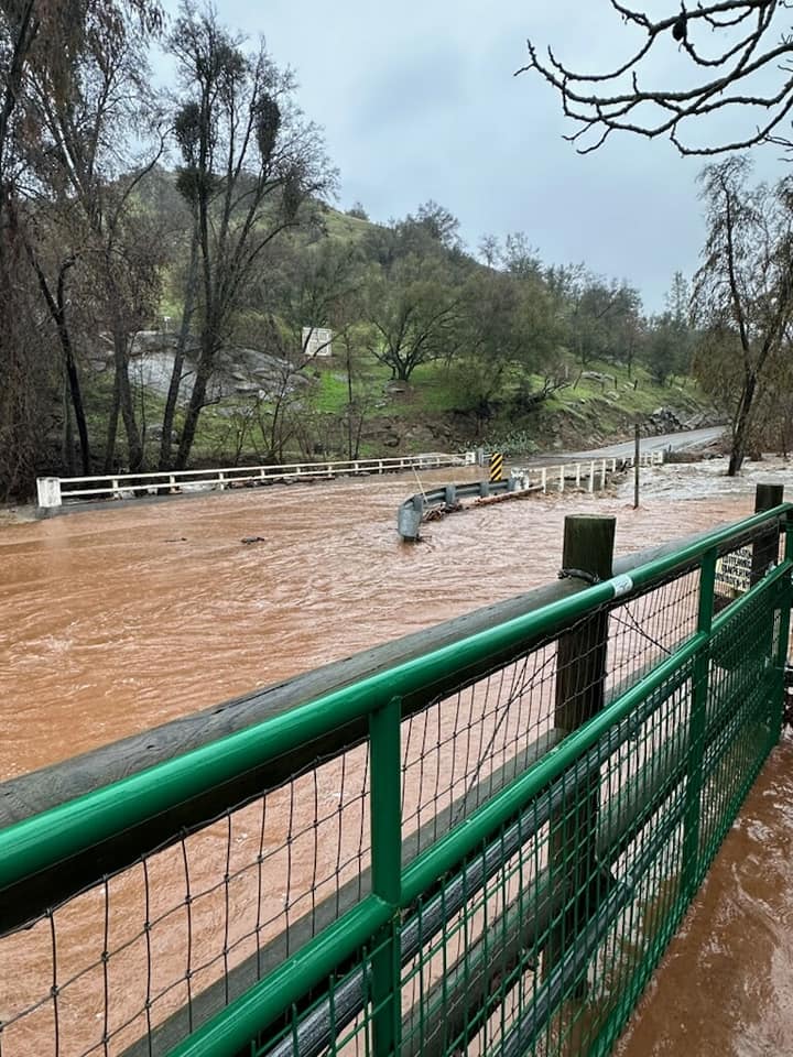
March 14, 2023 – Thunderstorms are just the latest natural hazard that has hit the Valley as of late, as even more rain and storms appear to be on the horizon.
The “atmospheric river” that has recently hit across Central California has been “unprecedented” according to several sources including the National Weather Service.
Many safety warnings have been given, and dangers have surrounded daily lives including closed roads, flooding, downed trees and powerlines and subsequent electrical blackouts causing further danger and even support from public shelters provided by the likes of the Red Cross.
It was reported that with winds up to 40 MPH, thunderstorms that rage across the Valley will have detrimental effect to the snowpack that was recently put in place from prior, colder weather rains.
In addition, the National Weather Service warns that all river forecast points of interest are expected to peak Tuesday evening, March 14th, less than a week after warnings were given of the incoming storm.
The Pajaro River levee rupture grew up to at least 400 feet since it failed late Friday according to officials in the area. This levee separates Santa Cruz and Monterey counties according to the Associated Press.
Further flooding in Monterey County was on the forecast as officials in this area believed that the Salinas River would also cause significant flooding to roadways and agricultural land.
With all of the flooding this year, what does this mean for Clovis? Well, according to the Associated Press the California Department of Water Resources online data showed Monday that the water content of the Sierra snowpack was 207% of the April 1 average, when it is normally at its peak.
In the Southern Sierra it was 248% of the average. Although it is believed that the incoming storm won’t be as extreme in terms of warmth, the rain that continues to fall on soil will continue to oversaturate the soil, further complicating matters for a number of outlets including farmlands.
In these unprecedented times there must be an unprecedented answer, and with the future forecast bringing further rains and storms, the approaching future must be planned and prepared for.
In order to receive emergency alerts from the Fresno County, please visit fresnocountyemergency.org.